Generating Maps with Cairn2e
Review of Worldbuilding Tools
Welcome back to the Dippin’ Dots of DND: 90% air; Welcome back to Gnomestones. Everything on this blog thus far has been sardonic, melodramatic, or agitational, but now I’m going to try and pivot into the instructional. I apologize in advance.
I like testing out worldbuilding tools. I appreciate a good map. Let’s try out the tools in Cairn2e.
One sign of a good set of worldbuilding tools is when they can be used to make a world from scratch. It’s best to go in order.
From the text:
Here we go. Dice, sketch paper, pen.
The Cairn2e Warden’s Guide begins with a section called ‘Setting Seeds’. First we encounter Region Themes, followed by a section developing Factions.
Rolls are indicated this this way —> :14, Example
Looks like the some of the region’s residents are interested in greater unity, at the risk of bucking their history of reclusivity. In addition, there’s a tools trade going on. Each settlement has what the other needs. Factions come next.
Can you make a map without using the faction section? Possibly, but it might not be as nuanced in the end. I think these faction did influence the creation process positively. It would probably be fine to do the factions after the map is already underway.
Now we get to Topography. Cairn2e uses a ‘Dice Drop’ method, where locations are placed based on where the dice land. The face-up number denotes the types of terrain underneath. You roll 1d6 to determine how many dice to drop.
I was fully prepared to roll a ‘1’ and be annoyed with my mono-biomed map. However, I rolled a ‘4’. In the future, I would roll a d4 to represent 3-6 regions.
This involved several rerolls and then scooting the dice around to where I wanted them to be. I also changed the eastern region to be Rough terrain, and the northern to be Perilous. I don’t necessarily feel proud about this gerrymandered hackjob.
In the future, I would go 1-2: Easy, 3-4: Tough, 5-6 Perilous. That way we won’t over-sample the Easy sections.
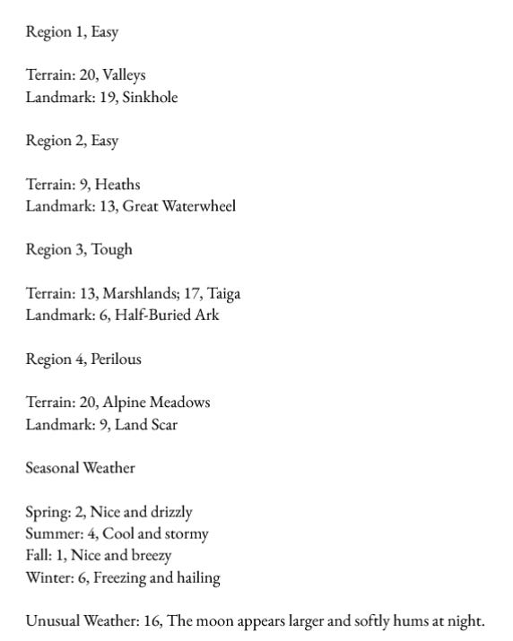
Here I add the river, flowing from the alpine meadow, through the valley region, and past the heaths with the waterwheel. Below are the region rolls.
At this point the Warden’s Guide shows a map with region and landmark art filled in. I would wait to do the Points of Interest before you do this. The POI section is coming up next.
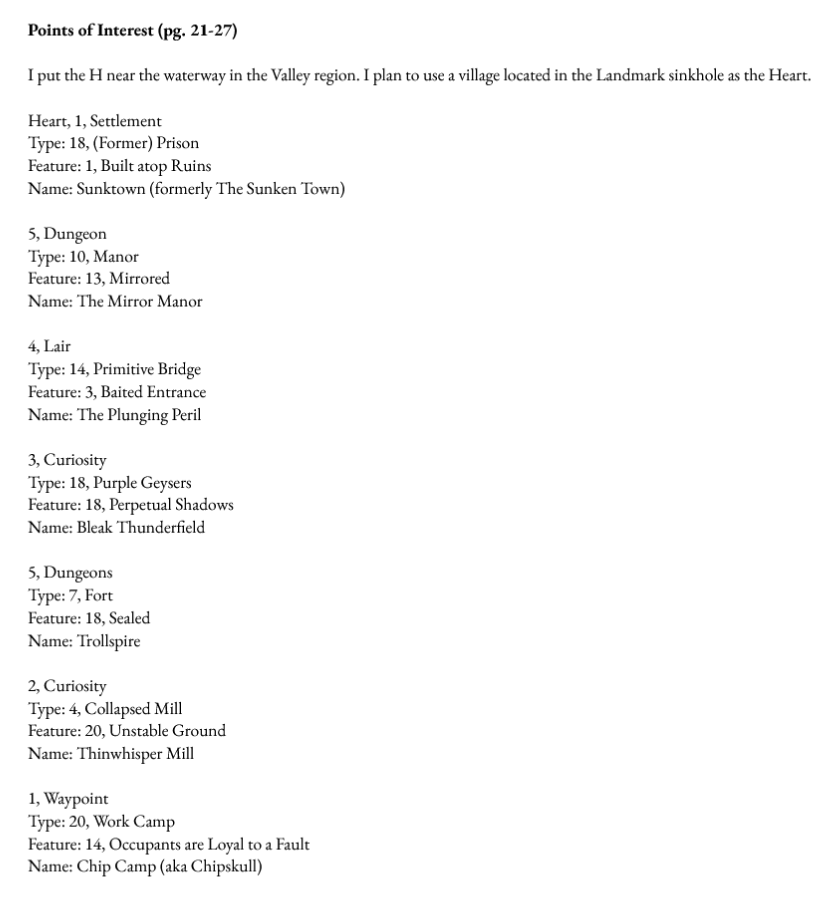
Again, this balance will result in heavy usage of the Curiosities, while the Waypoint and Settlement seeds are less likely. I end up adjusting some of the rolls, as well as spacing them out. I recommend the maximum 8 POIs.
In addition to the Point of Interest rolls, the names are generated with rolls in the Naming Section, pg. 116-123. I did stick as much as possible to the d6 Names Formula, but most of the names have enough personal filter that I cannot reproduce the process.
At this point, I re-realize that there is a whole separate section for forest locations. I rather not miss out on that section, so I decide to fill the south-east with forest. One should probably go into this process planning to fill 1/2 to 2/3s of the map with region locations, and the remaining space with forest locations.
The locations are all set, but I also want to determine paths and trails before I add landscape details. I roll the path details, and then retroactively decided where that trail would best fit. I was able to go counter-clockwise from the south without much deviation.
Now we’re all set to fill it in.
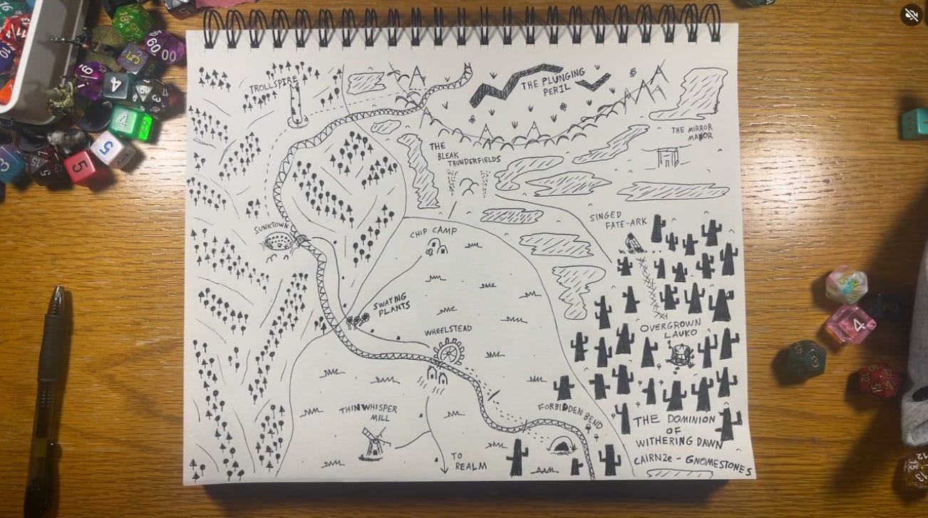
Here it is! I’m happy with the result. If you follow the underlying rolls, there’s already quite a story going on. Questions abound:
What are the tools traded between Sunktown and Wheelstead? How is this vital resource trade maintained?
Who is the new charismatic leader of Sunktown, the criminal-peddler, who seeks to cultivate resources, and what do they seek?
What brings the new rebel Lord to this lacrimose border region, The Dominion of Withering Dawn? Does the Lord support the mysterious pilgrims, the cult led by the enigmatic academic?
Why is the Trollspire sealed? Who is living in the cave at Forbidden Bend, and what are they searching for?
Why are the efforts to build Kingsmarch into the Secluded Henges going poorly? Where did the Singed Fate-Ark come from?
Do gnomes live in The Plunging Peril? (yes)
—
As a set of worldbuilding tools, Cairn2e does provide highly creative and whimsical maps. It is medium high in reusability. This is because some of the creative options are fairly specific. For example, Wheelstead is great, but I’m not going to use a similar Great Waterwheel landmark in the future map. There’s only one Wheelstead.
One way to create more variation is to scramble the terrains and the landmarks. The perilous landmarks are mostly too much for the easy terrain, but the forest POIs can be scrambled in as well.
Usage of the D100 nous and adjectives chart (pg. 116-123) is key. I suggest have multiple PDF tabs open to use the two resources side by side.
Will I use this map? I could play on it one day. I’ll certainly place it within the world of Gnomestones, probably in the northern corner of Rutne. As an NSR-style map generation tool, it’s an excellent choice.


Enjoyed the read, nice idea for an article
Nice post! It’s was cool to see these tools in action